
The community council meets at 7:30PM on the first Monday of every month except July. The venue for the next meetings is the Village Club. Specific meeting details are given at the end of this page.
Read MorePolice Scotland provides a monthly report covering incidents and advice for the Forth & Endrick rural area. The full reports for June and July are here: Police report CC_June_2026 Police...
Read More
As a result of a long campaign by the Community Council backed by the results of the Local Place Plan consultation, we received the following information about proposed traffic calming measures on the A81. This morning we have received permission to share this with residents to gather comments on behalf of Stirling Council. If you have any comments about these proposals please send them to the Community Council email address - contact@strathblanecc.org.uk - by September 25th
There will be comprehensive maps in the BVB and on the notice boards next week.
Proposed Road Safety Improvements – A81 Blanefield & Strathblane
Stirling Council has a statutory duty under the Road Traffic Act 1988 to prepare and carry out programmes to promote road safety, study local traffic collisions and take steps to prevent them. Under this duty a programme of traffic surveys was undertaken in late 2025 across all village locations subject to a 20mph speed limit within the Stirling Council area. This traffic survey information was analysed and weighted for traffic volumes and speeds, before being combined with the five -year collision data to the end of 2025 which was weighted for collision and casualty severity as well as the involvement of vulnerable road users. The analysis of this data produced a score and ranking for each village location, providing a priority list for the consideration of traffic calming measures. Due to budget restrictions, only those villages at the top of the priority list can be considered in the 2026/27 financial year, Blaenfield and Strathblane being one such location.![]()
To reduce vehicle speeds on the A81 through Blanefield and Strathblane, particularly at potential conflict points, several raised table junctions are proposed. These will be located at the following junctions on the A81:
• Milngavie Road with Dumbrock Road.
• Milngavie Road with Campsie Road and Glasgow Road, mini roundabout to be retained.
• Glasgow Road with Kirkhouse Road, mini roundabout to be retained.
• Glasgow Road with Campsie Dene Road.
• Glasgow Road with Netherblane.
• Glasgow Road with Ballewan Crescent.
In addition to the raised table junctions, the existing pedestrian crossing point to the west of the junction with Wester Leddigreen Road will also be placed onto a raised table maintaining the existing priority system arrangement.
Each raised table will include the following features:
• Table will be raised 75mm above existing carriageway level.
• Ramps to be installed on all approaches at 1.5m wide providing a gradient of 1 in 20.
• Kerb upstand through raised table to be 25mm apart from at the tactile paving crossing points which will be maximum of 6mm upstand.
• All existing junction ‘Give Way’ and mini roundabout markings will be reinstated on new raised tables.
• All gullies will be adjusted to new carriageway levels.
The existing 20mph speed limit from a point approximately 20 metres north-west of the junction of the A81 and Netherblane to the existing 20mph speed limit extents approximately 75 metres to the south of the junction between the A81 and Dumbrock Road will be converted to a 20mph zone thereby allowing the installation of ‘Traffic calmed area’ signs to be erected at each entry point.
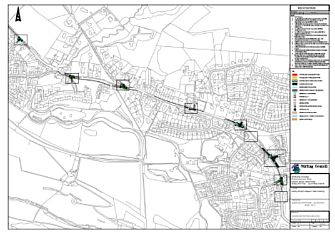
A series of drawings showing the proposed raised table junctions, is enclosed for your information.
As a result of a long campaign by the Community Council backed by the results of the Local Place Plan consultation, we received the following information about proposed traffic calming measures on the A81. This morning we have received permission to share this with residents to gather comments on behalf of Stirling Council. If you have any comments about these proposals please send them to the Community Council email address - contact@strathblanecc.org.uk - by September 25th
There will be comprehensive maps in the BVB and on the notice boards next week.
Proposed Road Safety Improvements – A81 Blanefield & Strathblane
Stirling Council has a statutory duty under the Road Traffic Act 1988 to prepare and carry out programmes to promote road safety, study local traffic collisions and take steps to prevent them. Under this duty a programme of traffic surveys was undertaken in late 2025 across all village locations subject to a 20mph speed limit within the Stirling Council area. This traffic survey information was analysed and weighted for traffic volumes and speeds, before being combined with the five -year collision data to the end of 2025 which was weighted for collision and casualty severity as well as the involvement of vulnerable road users. The analysis of this data produced a score and ranking for each village location, providing a priority list for the consideration of traffic calming measures. Due to budget restrictions, only those villages at the top of the priority list can be considered in the 2026/27 financial year, Blaenfield and Strathblane being one such location.![]()
To reduce vehicle speeds on the A81 through Blanefield and Strathblane, particularly at potential conflict points, several raised table junctions are proposed. These will be located at the following junctions on the A81:
• Milngavie Road with Dumbrock Road.
• Milngavie Road with Campsie Road and Glasgow Road, mini roundabout to be retained.
• Glasgow Road with Kirkhouse Road, mini roundabout to be retained.
• Glasgow Road with Campsie Dene Road.
• Glasgow Road with Netherblane.
• Glasgow Road with Ballewan Crescent.
In addition to the raised table junctions, the existing pedestrian crossing point to the west of the junction with Wester Leddigreen Road will also be placed onto a raised table maintaining the existing priority system arrangement.
Each raised table will include the following features:
• Table will be raised 75mm above existing carriageway level.
• Ramps to be installed on all approaches at 1.5m wide providing a gradient of 1 in 20.
• Kerb upstand through raised table to be 25mm apart from at the tactile paving crossing points which will be maximum of 6mm upstand.
• All existing junction ‘Give Way’ and mini roundabout markings will be reinstated on new raised tables.
• All gullies will be adjusted to new carriageway levels.
The existing 20mph speed limit from a point approximately 20 metres north-west of the junction of the A81 and Netherblane to the existing 20mph speed limit extents approximately 75 metres to the south of the junction between the A81 and Dumbrock Road will be converted to a 20mph zone thereby allowing the installation of ‘Traffic calmed area’ signs to be erected at each entry point.
A series of drawings showing the proposed raised table junctions, is enclosed for your information.
Trees and woodlands consultation – Open until 2 Sep 2026 - link in comments
Some updated information from Stirling Council regarding the closure of the A81 this week:![]()
“Good Afternoon,![]()
Stirling Council intend to undertake essential carriageway resurfacing works on the A81 Glasgow Road, Blanefield commencing on Thursday 20th of August for a period of 4 days, excluding weekends with all works being completed on Tuesday 25th of August (weather permitting). This timescale has been reviewed in consultation with the contractor to reduce disruption and the impact on the community as far as reasonably practicable.
The works involve the excavation of the existing carriageway, laying the new binder course, resetting any ironwork, laying the new surface course and reinstating the traffic islands.![]()
This section of carriageway was prioritised using our risk-based inspection matrix following site inspections, reported defects, complaints and increased insurance claims due to the poor condition.![]()
Unfortunately, it is not possible to undertake these works without a full road closure as we require a safe working zone keeping our workforce and road users free from any hazard or risk whilst the absolute minimum a vehicle running lane can be is 3m which is not achievable on this site meaning temporary traffic signals would not be appropriate.![]()
It is also not possible to undertake the works overnight due to the many residential properties in the area and restrictions on noise during the works period.![]()
Notification of the works has been done by resident letters; advance warning signs and all road works can be found here: Scottish Road Works Online![]()
We apologise for any inconvenience these works may cause; however, we aim to keep this as minimal as possible and complete the works in a timely manner.![]()
Regards,
Alistair Schofield, Team Leader - Roads Maintenance”
Below you will find two links to the surveys that Stirling are asking residents to complete. Apologies as these links should have been in the BVB.![]()
The first survey (Spatial Awareness) is onerous so if you find it too difficult please move on to the Sites link. This is the more important of the two surveys. ![]()
Please remember that the most popular site identified by residents on our Local Place Plan is STB-03 on the map which is on either side of the A81 between Ballewan Crescent and the Care Home. Other sites on the map are being proposed by developers. ![]()
This survey needs to be completed by the 22nd of July.![]()
To respond to the Spatial Strategy survey engage.stirling.gov.uk/en-GB/projects/spatial-strategy![]()
To respond to the Site Options survey engage.stirling.gov.uk/en-GB/projects/site-options![]()
The full description of the sites is in the Site Options Paper referenced in the survey but the key issue is the site references numbers shown in the attached map.![]()
It is important you have your say about developments in our community.